Windows
Mac
Windows
Log in / Sign up
Windows
›
Tags › satellite image
Most popular
Satellite Image
software
Relevance
Popularity
Rating
Garmin BaseCamp
free
49,184
Garmin Ltd or its subsidiaries
This program is designed to help you planning outdoors activities such as travels, hiking, and such. It may sound like...
roads, highways, streets and
satellite
images
FormIt Converter For Revit
42,796
Autodesk
Use real building and environmental data to support design brainstorming...
site information, such as
satellite
images
, to orient your designs
MapInfo Professional
19,180
Pitney Bowes Software Inc.
This program lets you present information from different sources in a map...
Maps are a very useful and clear way to present data. This program lets you present
NASA World Wind
free
5,155
NASA
With this SDK, developers can embed World Wind technology in their own applications...
With this SDK, developers can embed World Wind technology in their own applications. The API
AutoCAD Raster Design
2,419
Autodesk Inc.
AutoCAD Raster Design is a comprehensive software program used to create, edit and analyze 3D projects...
able to erase raster
images
, lines, arcs ...and polylines from raster
images
and convert
TerraExplorer
2,387
Skyline Software Systems, Inc.
TerraExplorer is a 3D GIS desktop viewer and creator. Using its 3D interface, you can view, query, analyze...
by fusing aerial and
satellite
photography
ILWIS Academic
free
2,252
ITC
When looking for a powerful tool to satisfy various needs regarding...
vectors, raster and
satellite
imagery ...using
images
from
satellite
(that have a domain
Image
DesktopEarth
free
1,548
Márton Anka
Desktop Earth is a wallpaper generator that creates desktop Earth representation backgrounds...
time cloud imagery from
satellite
data and 33-megapixel
Radar Screensaver
1,018
ZERGE.COM
Have you ever wanted to be a flight controller? Would you like to work...
sounds. The screensaver includes a
Satellite
-powered Identification
Ultimate Maps Downloader
981
Lizard Labs
Ultimate Maps Downloader is a detailed mapping software that allows you to download map...
in one big map
image
for offline use...and tiles in several
image
formats. You can select
HOLUX ezTour for Logger
free
945
HOLUX Technology, Inc.
HOLUX ezTour for Logger lets you visualize your tracks on Google Maps. Google Maps are available also a Track...
HOLUX ezTour for Logger lets you visualize your tracks on Google Maps. Google Maps
CompeGPS LAND
851
CompeGPS TEAM S.L.
CompeGPS LAND is a program that lets you work with all types of maps including topographic...
topographic, vectorial, and
satellite
pictures. This application...common map and
image
formats. It can
MapSphere
free
583
MapSphere
MapSphere is a mapping software for Windows that:downloads maps and SATellite Images...
that:downloads maps and
SATellite
Images
from different sources (OpenStreetMap
Bhuvan
free
583
AYAN TECHNOLOGIES PVT LTD
Bhuvan gives you an easy way to experience, explore and visualize IRS images...
globe, scanning
satellite
imagery...and overlay separate
images
onto the application
Exif Tag Remover
free
561
RL Vision
Exif Tag Remover allows you to easily delete all metadata tags. By doing so before publishing an image you take...
before publishing an
image
you take...formats, supports 35
image
formats, optionally obfuscates
Satellite TV PC Master
525
Satellite TV PC Master
Satellite TV PC Master is award winning software due to an easy to use PC program that legally...
Quality sound and
image
streaming guaranteed...All over The World
Satellite
TV PC
GRLevel3
384
Gibson Ridge Software
GRLevel3 is a Windows viewer for live and archive NEXRAD Level III data...
GRLevel3 is a Windows viewer for live and archive NEXRAD Level III data. It displays high-resolution
Tracking The Eye.NET
326
GenCode Systems, Inc.
The Tracking The Eye's extended Internet service will send you real-time satellite images, storm coordinates...
Tracking The Eye is a full hurricane tracking application that can connect to the Internet and get
Map View
152
OfflineSoft
Map View is a professional online map browser. Both satellite imagery and maps...
map browser. Both
satellite
imagery and maps...also provides powerful
image
capture function
Weather1
141
Kelly Software
Weather1 is the best weather software that keeps you updated of current weather conditions...
Warnings & Advisories, radar and
satellite
images
and much more! Weather1
1
2
3
4
5
6
7
Tags
Map
Maps
Satellite
GPS
Satellite images
Image
Photos
Mapping
Geographic
Imagery
Featured stories
See all
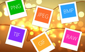
So Many Image Formats
How often do you pay attention to the format of the picture you are downloading? I would guess you almost never do. But do you know how many of them...
Protect Your Images With Watermarks
When you sharing your photos and pictures on the Internet, you can't be too sure whether they're used properly and are not stolen from you and...
Take a Better Screenshot Image with Snagit, Jing and Skitch
Take a peek at the three most popular screen capture applications and pick up the best one.
5 Best AI image generators in 2022
We have gathered five services based on neural networks that will help you create your own bizarre and captivating images.
Microsoft plans to compare ARM laptops to M3 MacBooks
Yet another reason to consider a Windows laptop with an ARM processor on board.