Windows
Mac
Windows
Log in / Sign up
Windows
›
Tags › satellite image
Most popular
Satellite Image
software
Relevance
Popularity
Rating
Plex.Earth Tools for AutoCAD 2010-2011
68
Plexscape
Plex.Earth Tools for AutoCAD 2010-2011 is a program that gives you all the tools you need to utilize satellite imagery...
need to utilize
satellite
imagery...fill with high-res
images
, create elevation contours
Smooth Meteor
free
52
Les Hamilton (2014-15)
SmoothMeteor is designed to stretch Meteor 3M N2 images laterally to compensate for foreshortening caused by Earth's...
NOAA and Metop
satellites
. But the
images
MapObjects
13
ESRI
MapObjects is a set of mapping software components that let you embed maps into your applications...
shapefiles. -Draw
images
from aerial photography or
satellite
imagery. -Dynamically
CLEA Module - The Moons of Jupiter (Version 2.113)
free
4
Project CLEA
The software provides a view of Jupiter at four magnifications (actual Voyager images...
magnifications (actual Voyager
images
are used), along...the four Galilean
satellites
in their proper
EduSpace Image Catalog Viewer
free
TerraNova Sistemi Informativi Territoriali
The application is composed principally by two main viewers, positioned in the centre of the application...
EduSpace
Image
Catalog...application, the first showing
satellite
images
from data-bank
NOAA Weather and Climate Toolkit
free
NOAA's Weather and Climate Toolkit is an application that provides simple visualization...
The export of
images
and movies is provided...gridded formats - GOES
Satellite
AREA Files - NEXRAD
Proactive Information Corporation Interactive Real Time Turbulence Screen Saver
free
Proactive Information Corporation
See the latest U.S. weather forecast, radar and satellite pictures to find turbulence when you're...
forecast, radar and
satellite
pictures to find turbulence...America. See seven
images
all updated
1
2
3
4
5
6
7
Tags
Satellite
Weather forecast
Meteor images
Smooth meteor
Meteor M2
Stretch images
Elevation countours
Create mosaics
Terrain data
Satellite imagery
Featured stories
See all
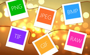
So Many Image Formats
How often do you pay attention to the format of the picture you are downloading? I would guess you almost never do. But do you know how many of them...
Protect Your Images With Watermarks
When you sharing your photos and pictures on the Internet, you can't be too sure whether they're used properly and are not stolen from you and...
Take a Better Screenshot Image with Snagit, Jing and Skitch
Take a peek at the three most popular screen capture applications and pick up the best one.
5 Best AI image generators in 2022
We have gathered five services based on neural networks that will help you create your own bizarre and captivating images.
Microsoft plans to compare ARM laptops to M3 MacBooks
Yet another reason to consider a Windows laptop with an ARM processor on board.
 TerraNova Sistemi Informativi Territoriali