Windows
Mac
Windows
Log in / Sign up
Windows
›
Tags › satellite image
Most popular
Satellite Image
software
Relevance
Popularity
Rating
Gravity
free
195
Uranisoft
Gravity is a program to simulate the path of move for bodies (i.e...
outside and making it a
satellite
of its own...paths in addition to
imaging
them. Sitting
APTDecoder
free
116
Patrik Tast Software
APTDecoder is a method of broadcasting cloud pictures from satellites. APTDecoder can create four grayscale...
image
(fully decoded) while recording signals transmmitted from the
satellite
Crash Zone
100
The CAD Zone, Inc.
Crash Zone is a drawing program for accurately mapping crash scenes...
high-resolution, 3D graphics,
satellite
image
clean-up and draping
GPS Data Logger
free
76
Club Cruceros de La Paz A.C.
The program accepts NMEA GPS sentences from most GPS receivers that connect to a USB port. The program can display...
The program can display
satellite
images
of waypoint locations
Map Export
68
OfflineSoft
Map Export is a GIS developer oriented tool for downloading and exporting background image. For a long time...
downloading and exporting background
image
. For a long...can export both
satellite
imagery
Easy Yahoo Maps Downloader
46
getallmaps.com
Easy Yahoo Maps Downloader lets you download map images. This app lets you specify...
between two map types (
satellite
or map) and select...) and view the
images
from within the application
TerraAmazon
free
43
TerraAmazon
TerraAmazon is a GIS tool designed to be a multi-user editor of geographic...
TerraAmazon is a GIS tool designed to be a multi-user editor of geographic vectorial data
Mp3 Music Organizer
41
Music Organizing Software, Inc.
Powerful Mp3 Music Organizer, Renamer, Sorter, that will sort, organize, rename all your files, fast and easy...
\Monthly report.doc";
Images
- "photos\5486.jpg...sorter, renamer;
Image
galleries (JPG,BMP,PNG
Universal File Organizer
33
Music Organizing Software, Inc.
Powerful file organizer, file sorter, file renamer, that will sort, organize, rename all your files...
\Monthly report.doc";
Images
- "photos\5486.jpg...sorter, renamer;
Image
galleries (JPG,BMP,PNG
GeoSatSignal
30
David Taylor
GeoSatSignal is a development of the SatSignal program, designed to process geostationary satellite data...
geostationary
satellite
data. Main features: - Process many standard
image
Global Overlay Mapper
free
26
MapAbility
Each map has a background, 12 active layers, and custom Scalebar. 2204 Major Cities - Europe:323, Asia:517, Africa...
1 World Map, with specialised
satellite
images
and world region-boundaries
Tech-Pro World Clock
25
Tech-Pro Limited
Tech-Pro World Clock 2 is a Windows desktop accessory that shows the date and time on a world map. It helps you keep track...
cover from recent weather
satellite
images
. The map is resizable
Astro-Mania
24
Sheppard Software
Astromania is an educational game that teaches and tests your knowledge on astronomy by means of a few simple...
like the planets, galaxies,
satellites
, stars, stellar objects like
Fantastic Worlds Free Screensaver
free
20
Mega-Screens.com
Slideshow-style screensaver featuring artistic renderings of celestial bodies and related phenomena...
Nevertheless, some
images
can...exotic planets, asteroids,
satellites
, galaxies
Space Flights Free Screensaver
free
15
Mega-Screens.com
Beautiful collection of photographs of space shuttles and stations in the form of a slideshow...
was the first artificial
satellite
to Earth's...you can view
images
of astronauts working
Free Space Screensaver
free
11
3D ScreenSaver Jam
Free Space Screensaver will put you on the driver’s seat of a spaceship...
planets with their natural
satellites
circling around them
Trellian WorldTime
free
9
Trellian Limited
World Time is a simple to use but intelligent graphical utility that displays...
the world using
satellite
imaging
technology...use of actual
satellite
images
. You can
TatukGIS AIC
9
TatukGIS
The AIC is an easy to use, stand-alone photogrammetry product designed to rectify...
and mosaic aerial photographs,
satellite
images
, or raster maps
Catfood Desktate
8
Catfood Software
Catfood Desktate is an eye catching earth simulator that combines satellite imagery and near...
includes several
satellite
images
and you can...composite weather
satellite
cloud
images
(updated
TerraExplorer Plus
4
Skyline software systems Inc.
With TerraExplorer Plus, you can overlay the terrain with imagery layers containing geo...
containing geo-referenced,
satellite
or aerial
images
and replace
1
2
3
4
5
6
7
Tags
Satellite
Map
World
Space
File renamer
Mp3 organizer
Mp3 renamer
Music organizer
File Organizer
Music renamer
Featured stories
See all
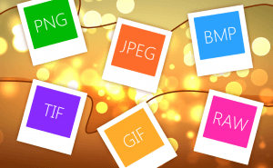
So Many Image Formats
How often do you pay attention to the format of the picture you are downloading? I would guess you almost never do. But do you know how many of them...
Protect Your Images With Watermarks
When you sharing your photos and pictures on the Internet, you can't be too sure whether they're used properly and are not stolen from you and...
Take a Better Screenshot Image with Snagit, Jing and Skitch
Take a peek at the three most popular screen capture applications and pick up the best one.
5 Best AI image generators in 2022
We have gathered five services based on neural networks that will help you create your own bizarre and captivating images.
Microsoft plans to compare ARM laptops to M3 MacBooks
Yet another reason to consider a Windows laptop with an ARM processor on board.