Windows
Mac
Windows
Log in / Sign up
Windows
›
Tags › satellite image
Featured
Satellite Image
Software
Relevance
Popularity
Rating
Garmin BaseCamp
free
49,138
Garmin Ltd or its subsidiaries
This program is designed to help you planning outdoors activities such as travels, hiking, and such. It may sound like...
roads, highways, streets and
satellite
images
MapInfo Professional
19,171
Pitney Bowes Software Inc.
This program lets you present information from different sources in a map...
Maps are a very useful and clear way to present data. This program lets you present
GRLevel3
384
Gibson Ridge Software
GRLevel3 is a Windows viewer for live and archive NEXRAD Level III data...
GRLevel3 is a Windows viewer for live and archive NEXRAD Level III data. It displays high-resolution
Microsoft VirtualEarth Satellite Downloader
340
AllAllSoft
Microsoft VirtualEarth Satellite Downloader is a program that helps you get...
get small tile
satellite
images
from Microsoft...downloaded maps by
Satellite
Tracking The Eye.NET
326
GenCode Systems, Inc.
The Tracking The Eye's extended Internet service will send you real-time satellite images, storm coordinates...
Tracking The Eye is a full hurricane tracking application that can connect to the Internet and get
Microsoft VirtualEarth Map Downloader
183
AllAllSoft
Microsoft VirtualEarth Map Downloader is a tool designed to get small tile map images...
small tile map
images
from Microsoft...All downloaded
images
PANCROMA
155
PANCROMA
PANCROMA is a professional satellite image processing program that enables you to add multispectral...
a professional
satellite
image
processing program...add multispectral
image
prospecting
Imaging PVR
150
Imaging Intelligence Ltd
Imaging PVR is TV card software giving you entertainment. Main features...
Imaging
PVR is TV card
mceWeather
free
137
Scendix Software, Inc.
mceWeather is a program that shows your present local weather and a forecast for the next...
the world, it displays a
satellite
image
of your country
Easy Ovi Maps Downloader
102
AllmapSoft
Easy Ovi Maps Downloader can automatically download Ovi Maps (Nokia maps, here maps) images to your PC...
tiles of normal map,
satellite
, hybrid ...the small
images
into a larger map
image
using
GPS Data Logger
free
76
Club Cruceros de La Paz A.C.
The program accepts NMEA GPS sentences from most GPS receivers that connect to a USB port. The program can display...
The program can display
satellite
images
of waypoint locations
FsMovMapServer
free
44
RahSim
FsMovMapServer is a moving map application designed for Microsoft Flight Simulator X (FSX...
provides features such as: -
satellite
mode on/off - center
Trellian WorldTime
free
9
Trellian Limited
World Time is a simple to use but intelligent graphical utility that displays...
the world using
satellite
imaging
technology...use of actual
satellite
images
. You can
OSEI Image of the Day
free
4
Opera Software
OSEI Image of the Day is an opera widget who brings you daily different pictures...
OSEI
Image
...from the Nationa Environmental
Satellite
Data
PhotoMapper
free
3
copiks
PhotoMapper will assist in organizing your memories by adding a geographic position to the EXIF...
quickly view aerial or
satellite
imagery
1
2
3
4
5
6
7
Tags
Satellite images
Satellite
Downloader
Maps
Images
Weather forecast
Satellite imaging
Satellite map
Create maps
Microsoft
Featured stories
See all
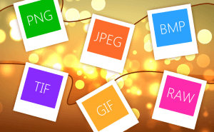
So Many Image Formats
How often do you pay attention to the format of the picture you are downloading? I would guess you almost never do. But do you know how many of them...
Protect Your Images With Watermarks
When you sharing your photos and pictures on the Internet, you can't be too sure whether they're used properly and are not stolen from you and...
Take a Better Screenshot Image with Snagit, Jing and Skitch
Take a peek at the three most popular screen capture applications and pick up the best one.
5 Best AI image generators in 2022
We have gathered five services based on neural networks that will help you create your own bizarre and captivating images.
Logitech offers a hardware-driven way to make use of AI
One of the world's biggest hardware makers seeks to make AI closer to everyone with the help of a button.