Windows
Mac
Windows
Log in / Sign up
Windows
›
Tags › satellite image
Featured
Satellite Image
Software
Relevance
Popularity
Rating
FormIt Converter For Revit
42,796
Autodesk
Use real building and environmental data to support design brainstorming...
site information, such as
satellite
images
, to orient your designs
TerraExplorer
2,387
Skyline Software Systems, Inc.
TerraExplorer is a 3D GIS desktop viewer and creator. Using its 3D interface, you can view, query, analyze...
by fusing aerial and
satellite
photography
HOLUX ezTour for Logger
free
945
HOLUX Technology, Inc.
HOLUX ezTour for Logger lets you visualize your tracks on Google Maps. Google Maps are available also a Track...
HOLUX ezTour for Logger lets you visualize your tracks on Google Maps. Google Maps
What Watch
free
283
Robert Amlung
What Watch is a powerful tool that covers many areas and techniques of astrology. The program draws and prints...
What Watch is a powerful tool that covers many areas and techniques of astrology. Its purpose
GeoVisu
free
281
GeoVisu
GeoVisu is a program that displays georeferenced data (images, graphics)...
Displays geolocalized Jpeg
images
(Exif) - Directly...for maps and
satellites
image
layers using
Crash Zone
100
The CAD Zone, Inc.
Crash Zone is a drawing program for accurately mapping crash scenes...
high-resolution, 3D graphics,
satellite
image
clean-up and draping
Free Mercedes Screensaver
free
56
3D ScreenSaver Jam
This screensaver takes a tour about the history of one of the most famous car industries. Mercedes was founded in 1883 by Karl...
effects, the high-quality
images
, the variety of camera
Bible Mapper Application
43
BarrettWare
This multi-featured program allows you to create customized maps...
even have Google Earth's
satellite
view of the spot
Mars 3D Space Survey Screensaver
35
Digital Minds Software
Mars 3D Space Survey Screensaver will show images...
Screensaver will show
images
...the environment, its
satellites
and more
Weather Screen
free
31
WeatherScreen
Weather Screen puts information about the weather and more on your screen...
different kinds of maps:
satellite
, highs and lows, etc
Global Overlay Mapper
free
26
MapAbility
Each map has a background, 12 active layers, and custom Scalebar. 2204 Major Cities - Europe:323, Asia:517, Africa...
1 World Map, with specialised
satellite
images
and world region-boundaries
Tech-Pro World Clock
25
Tech-Pro Limited
Tech-Pro World Clock 2 is a Windows desktop accessory that shows the date and time on a world map. It helps you keep track...
cover from recent weather
satellite
images
. The map is resizable
Astro-Mania
24
Sheppard Software
Astromania is an educational game that teaches and tests your knowledge on astronomy by means of a few simple...
like the planets, galaxies,
satellites
, stars, stellar objects like
CombiPlotter
24
COAA
CombiPlotter plots aircraft, spacecraft, weather balloons and ships in your local area...
data (for example, over a
satellite
image
, in parallel with a nautical
Sardinia Photoreal FSX & P3D part1
free
14
Diego PapaRella
Sardinia Photoreal FSX & P3D part1 is an add-on for Microsoft Flight Simulator...
The photo-real
images
(obtained by
satellite
) are LOD14
GV-GIS
free
13
GeoVision Inc.
The vehicle tracking and remote location verification from the GV-GIS is made possible by the GPS...
and speed) from the
satellite
, and through
Free Space Screensaver
free
11
3D ScreenSaver Jam
Free Space Screensaver will put you on the driver’s seat of a spaceship...
planets with their natural
satellites
circling around them
Australian Weather Monitor
free
10
Manning Software
Weather Monitor is a excellent weather tool which will provide you with up...
date weather conditions, radar
images
,
satellite
images
, synoptic charts, weather soundings
TatukGIS AIC
9
TatukGIS
The AIC is an easy to use, stand-alone photogrammetry product designed to rectify...
and mosaic aerial photographs,
satellite
images
, or raster maps
GeoImaging Tools
5
PCI Geomatics
Users now have the option to save the correction parameters into the Raster Processing Definition (RPDef...
Image
Correction Module, ArcGIS users can: -
Satellite
...Correct many
images
simultaneously using
1
2
3
4
5
6
7
Tags
Screensaver
Weather
Screen saver
Free screensaver
Space screensaver
Software
Program
Download
Space
Earth
Featured stories
See all
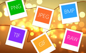
So Many Image Formats
How often do you pay attention to the format of the picture you are downloading? I would guess you almost never do. But do you know how many of them...
Protect Your Images With Watermarks
When you sharing your photos and pictures on the Internet, you can't be too sure whether they're used properly and are not stolen from you and...
Take a Better Screenshot Image with Snagit, Jing and Skitch
Take a peek at the three most popular screen capture applications and pick up the best one.
5 Best AI image generators in 2022
We have gathered five services based on neural networks that will help you create your own bizarre and captivating images.
Microsoft plans to compare ARM laptops to M3 MacBooks
Yet another reason to consider a Windows laptop with an ARM processor on board.