Windows
Mac
Windows
Log in / Sign up
Windows
›
Tags › satellite image
Top
Satellite Image
downloads
Relevance
Popularity
Rating
orchidmedia
4
Information Core Technologies
Orchidmedia provides email, instant messaging...
players and our photo/
image
viewer to organise...devices and TV Cable/
Satellite
Plex.Earth Tools for AutoCAD 2010-2015
497
Plexscape
Plex.Earth is an AutoCAD plugin that allows you to use satellite imagery...
allows you to use
satellite
imagery
PANCROMA
155
PANCROMA
PANCROMA is a professional satellite image processing program that enables you to add multispectral...
a professional
satellite
image
processing program...add multispectral
image
prospecting
Saturn 3D Space Survey Screensaver
61
Digital Minds Software
Saturn Space Survey Screensaver is a spectacular screensaver that includes astonishing views of Saturn and important...
about it. The
images
are of great quality...or not, and observe
satellites
. You can also select
FsMovMapServer
free
44
RahSim
FsMovMapServer is a moving map application designed for Microsoft Flight Simulator X (FSX...
provides features such as: -
satellite
mode on/off - center
TerraAmazon
free
43
TerraAmazon
TerraAmazon is a GIS tool designed to be a multi-user editor of geographic...
TerraAmazon is a GIS tool designed to be a multi-user editor of geographic vectorial data
AirPhotoSE
free
31
TUVSW
AirPhotoSE offers essential features needed for rectification of oblique aerial imagery with geo-referenced output...
of a large
image
simultaneously. Automatic...
images
with maps, orthophotos, or
satellite
pictures
CombiPlotter
24
COAA
CombiPlotter plots aircraft, spacecraft, weather balloons and ships in your local area...
data (for example, over a
satellite
image
, in parallel with a nautical
Space Fantasies Free Screensaver
free
15
Mega-Screens.com
A free slideshow-style screensaver featuring astounding images...
can see
images
of our planet Earth,
satellites
colliding...set the time each
image
remains on screen
Sardinia Photoreal FSX & P3D part1
free
14
Diego PapaRella
Sardinia Photoreal FSX & P3D part1 is an add-on for Microsoft Flight Simulator...
The photo-real
images
(obtained by
satellite
) are LOD14
GV-GIS
free
13
GeoVision Inc.
The vehicle tracking and remote location verification from the GV-GIS is made possible by the GPS...
and speed) from the
satellite
, and through
Trellian WorldTime
free
9
Trellian Limited
World Time is a simple to use but intelligent graphical utility that displays...
the world using
satellite
imaging
technology...use of actual
satellite
images
. You can
TatukGIS AIC
9
TatukGIS
The AIC is an easy to use, stand-alone photogrammetry product designed to rectify...
and mosaic aerial photographs,
satellite
images
, or raster maps
TerraBuilder PRO
9
TerraBuilder
TerraBuilder is a Windows based application intended to aid in the design and production...
size high altitude terrain
images
or
satellite
pictures into photorealistic
onAround Immageo
free
7
Immageo
It is all about making your photos as memorable as when you took them...
integrated global map or
satellite
imagery. Once located...geo-tag your
images
. Immageo can
GeoImaging Tools
5
PCI Geomatics
Users now have the option to save the correction parameters into the Raster Processing Definition (RPDef...
Image
Correction Module, ArcGIS users can: -
Satellite
...Correct many
images
simultaneously using
OSEI Image of the Day
free
4
Opera Software
OSEI Image of the Day is an opera widget who brings you daily different pictures...
OSEI
Image
...from the Nationa Environmental
Satellite
Data
TerraExplorer Plus
4
Skyline software systems Inc.
With TerraExplorer Plus, you can overlay the terrain with imagery layers containing geo...
containing geo-referenced,
satellite
or aerial
images
and replace
Easysatpix
free
2
Easysatpix
Easysatpix is a little software aiming to help the flightsim enthusiasts planning...
allows you to see
satellite
images
of Earth
WXRCV
free
1
K.S.
It is a little utility to automate the reception of the APT signal...
frequency just before the
satellite
pass (using...reception - audio editing -
image
editing
1
2
3
4
5
6
7
Tags
Satellite
Satellite images
Images
Flight Simulator
Software
Space
Weather
Terrain
Aircraft
Image processing
Featured stories
See all
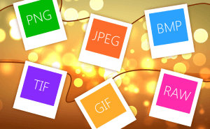
So Many Image Formats
How often do you pay attention to the format of the picture you are downloading? I would guess you almost never do. But do you know how many of them...
Protect Your Images With Watermarks
When you sharing your photos and pictures on the Internet, you can't be too sure whether they're used properly and are not stolen from you and...
Take a Better Screenshot Image with Snagit, Jing and Skitch
Take a peek at the three most popular screen capture applications and pick up the best one.
5 Best AI image generators in 2022
We have gathered five services based on neural networks that will help you create your own bizarre and captivating images.
Microsoft plans to compare ARM laptops to M3 MacBooks
Yet another reason to consider a Windows laptop with an ARM processor on board.